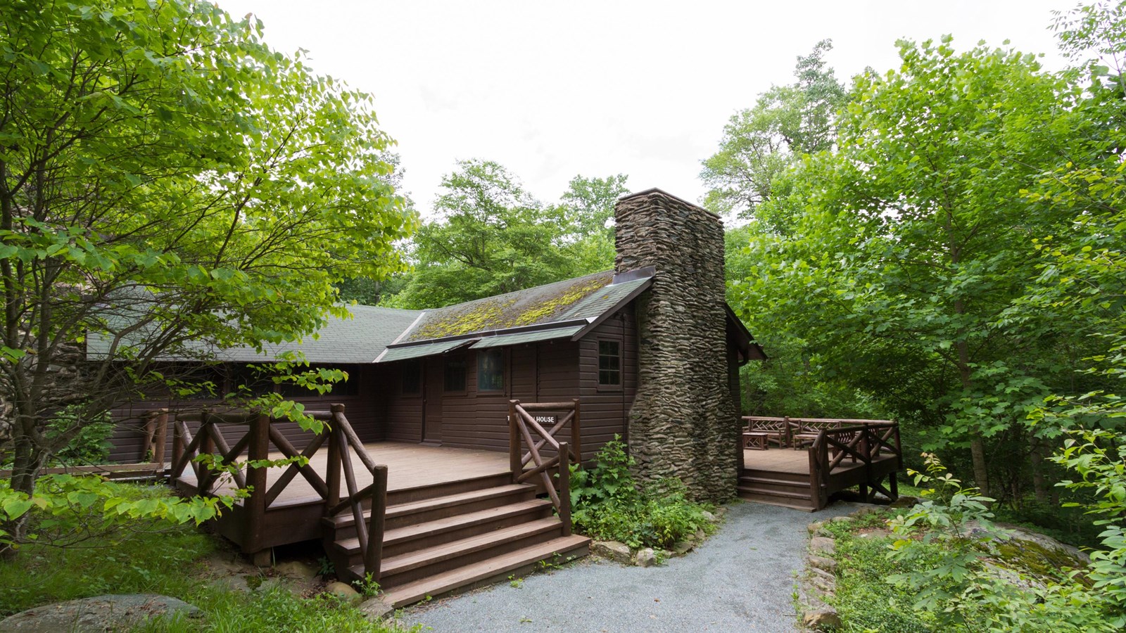
Photo: National Park Service (public domain)
Deep in the fold where Mill Prong and Laurel Prong join to form the Rapidan River sits a cluster of rustic buildings that were, for four years, the most important address in America outside Washington. Rapidan Camp — locals still call it Camp Hoover — was the first presidential retreat, and it exists because a president wanted to catch brook trout.

5+ private acres bordering Shenandoah National Park. Walk to Old Rag and White Oak Canyon. Whole property to yourself.
Herbert Hoover took office in 1929 and almost immediately went looking for somewhere to escape Washington's summer. His requirements were specific and, to anyone who has stood in D.C. in August, entirely reasonable: within about a hundred miles of the capital, above 2,500 feet for cool air and fewer mosquitoes, and — the part that decided it — on a trout stream.
Hoover was a serious fly fisherman. He later wrote about fishing as one of the few activities where a president is left alone. The Rapidan's headwaters held wild native brook trout, and that settled the question. He bought the land with his own money, built a camp of rustic cabins along the water, and later donated the property to what became Shenandoah National Park.
What happened there wasn't only fishing. Cabinet members came. Foreign dignitaries came — one cabin is still called the Prime Minister's Cabin after British PM Ramsay MacDonald's 1929 visit, where the two men reportedly talked disarmament sitting on a log by the stream. Camp David wouldn't exist for another decade. This was the prototype.
Three original buildings survive of a camp that once held more than a dozen, and the site is a National Historic Landmark:
What strikes most people is how modest it is. There's no grandeur — just plain buildings on a stream in a hemlock hollow, with stonework and a small trout pool. That restraint is the point, and it's the reason the walk in matters. Arriving on foot is the correct way to see it.
There is no route that isn't a commitment. Pick based on where you're staying and how long a day you want.
Roughly 4 miles round trip · moderate · about 3 hours. Park at Milam Gap on Skyline Drive, cross the Appalachian Trail, and descend the Mill Prong Trail alongside the stream to the camp. You lose elevation on the way in, which means the climb waits for the end — a detail that surprises people who assume "downhill hike."
This is the standard approach and the one I'd recommend to almost everyone. It's the shortest, the prettiest, and it passes Big Rock Falls on the way.
A wide gravel road running down to the camp from Skyline Drive. Longer and less scenic than Mill Prong on foot, but it's the cycling option and the route the ranger vans use. If you want to bike to a presidential retreat, this is how.
From the Graves Mill trailhead on our side of the mountains, you can work up the Rapidan drainage into the camp from below. This is a long, full-day expedition — significantly farther than Mill Prong — and it's the route almost nobody writes about.
It's also, historically, the honest one. Hoover's supply road came up from this side. The Marines who built the camp came from this side. If you're staying in Syria or Criglersville, you're already on the correct side of the mountain, and you can drive to Graves Mill in a fraction of the time it takes to get up onto Skyline Drive and around.
Do not attempt this casually. Carry a real map, start at first light, and know your turnaround time. Backcountry conditions apply and there's no cell service anywhere in that drainage.
Experienced hikers link Mill Prong, Laurel Prong, and the Appalachian Trail into loops of eight-plus miles, and backpackers combine the Graves Mill approach with Jones Mountain for overnight trips. Check current NPS backcountry permit requirements before planning anything overnight.
If hiking in isn't practical, the park runs seasonal ranger-led van tours from the Byrd Visitor Center at Big Meadows. They drive the fire road, and a ranger walks you through the buildings — including the Brown House interior — with the history in far more detail than any sign. There's a fee and they fill up; reserve ahead.
This is the accessible option for anyone who can't manage the trail, and honestly the best option for anyone who cares more about the history than the miles.
Birch's Library sits on 5+ private acres bordering Shenandoah National Park in Syria — the same side of the mountains as the Graves Mill approach, and right near Old Rag's Berry Hollow trailhead. A bold creek, two ponds, an 1865 log cabin built by a Union soldier of the 16th Maine, and a piano frame in the walkway that may have come down from Hoover's camp.
★ 5.0 on Airbnb (Guest Favorite) · 10/10 on Vrbo · Dogs welcome · Starlink Wi-Fi
Check dates at the cabin →
Yes — same place. The NPS uses "Rapidan Camp"; locals and older maps say "Camp Hoover."
About three hours round trip from Milam Gap at a relaxed pace, plus however long you linger. The Graves Mill approach is a full day.
Not in a private vehicle. The fire road is closed to general traffic; the ranger van tour is the way to arrive on wheels.
If you like history, absolutely — it's the birthplace of the presidential retreat, and it's remarkably intact. If you only want views, Old Rag delivers more. This hike is about the hollow, the water, and the strangeness of a president choosing somewhere so plain.
Yes, under Shenandoah's regulations — Virginia license, artificial single-hook lures only, brook trout released. It's the reason the camp exists. See the fishing guide →
The history under our feet, trail and water conditions, and what a Blue Ridge hollow looks like through the seasons.
Follow @hikeoldrag